Overview: Explore Module
The Explore module enables you to visualize and work with multiple datasets or artifacts in the platform. Think of the Explore module as your data command center, where you can layout and analyze all your data layers before diving into deeper analysis.
The module is designed to help you:
- Find the exact datasets you need
- Visualize data layers on one map
- Make informed decisions based on your data
- Keep track of complete, validated datasets
- Combine multiple data types in one view
You can work on multiple types of data in the Explore module, including:
- Archived files (ZIP/TAR)
- Geographic data (raster and vector formats)
- Documents
- Video files
How Does It Work? The Explore module can be accessed by all the users. When you open the Explore module, you will see a 3D globe interface built on industry-standard mapping services (ESRI basemap and OpenStreetMap).
You can do the following in the Explore module:
- Search for specific datasets in your system
- Browse through all the available data layers
- Upload your own datasets and view them in the Layers section
- Access new data through the acquisition portal
Accessing Explore sub-module
The Explore module is displayed by default when you login to gIQ.
To access the Explore module, do the following:
-
Login to platform.
-
Click the Globes module, and then click the Explore sub-module.
Navigating Explore sub-module
The Explore module is neatly divided into three main components:
-
Layers Panel
-
Map Panel
-
Contextual Details Panel
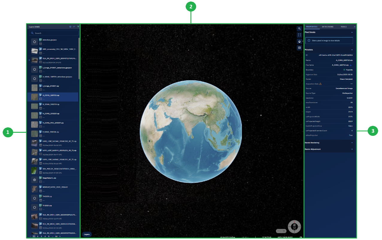
Layers Panel
In the Layers section, you can do the following:
-
Toolbar: View the number of layers uploaded to the platform, toggle footprints visibility of the layers, sort and filter layers.
-
Search bar: Search for a specific layer
-
Layers: Click a specific layer, zoom into the layer, get a perspective view, view layer details in a dynamic details section, and so on.
Map Interface Panel
By default, a 3D globe with ArcGIS as the basemap is displayed.
In the Maps section, you can do the following:
-
Change the basemap
-
Add base layers
-
Search the map for a specific location
-
Adjust globe and base layer translucency
-
Toggle map view
Contextual Details Panel
In the Dynamic Details section (depending on the type of layer that you select) you can do the following:
-
View properties of the layer namely ID, Name, File Name, Boundary, Acquisition Date, and so on
-
Run Models and view model run history. View, search, filter, and download detections and view categories
-
View Metadata
-
Execute resampling and run unsupervised algorithms