Navigating New Workspace Page
In this section, discover how you can navigate a new workspace page module.
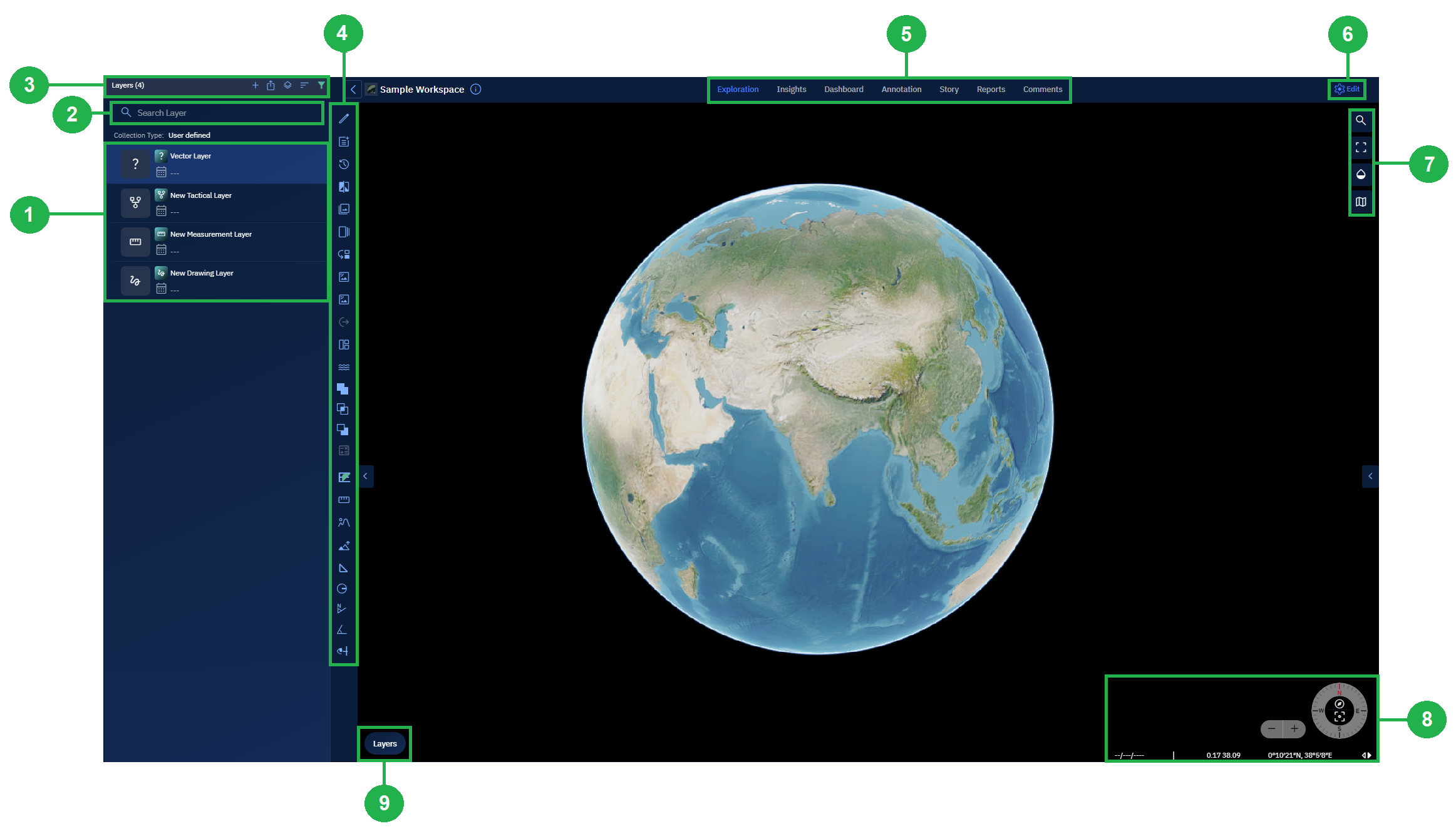
New Workspace Page Layout
The Workspace interface enables you to do a host of tasks and actions namely view all types of layers, search layers, add new layers/collections, edit workspaces, and so on...
| # | Element | Description |
|---|---|---|
| 1 | Layers List | View existing layers and any layers you add to the workspace in this section. |
| 2 | Search Layer | Quickly find a specific layer by name using the search bar. As you type, matching layers are dynamically filtered from the Layers List, making it easy to locate layers in workspaces with large datasets. |
| 3 | Layers Ribbon | Add new layers such as Drawing or Vector layers to the workspace. Includes features like toggling footprint visibility, sorting layers, and filtering them. |
| 4 | Analyst Tools | Execute spatial analysis tasks like comparing vector layers, image comparisons, ground length measurements, and more. |
| 5 | Workspace Tabs | Visualize and analyze datasets through modules such as Explore, Insights, Dashboard, Annotation, and Story. Each module supports different aspects of geospatial analysis. Common functionality is available in both the Explore module and Workspace page. |
| 6 | Edit Workspace | Modify workspace settings like its name, visibility (public/private), and dynamic filters. This is only available within the Workspace page. |
| 7 | Workspace Map Options | Navigate and control how the map is displayed. Jump to specific coordinates, switch to full-screen, adjust map transparency, or toggle map views. Common to both Explore module and Workspace page. |
| 8 | Azimuth & Lat-Long | Switch between Lat-Long and MGRS formats, zoom in/out, or reset azimuth for true north. Common to both Explore module and Workspace page. |
| 9 | Base Map Layers | Select or switch base maps for geographic reference. Overlay one or more data layers and choose a height map. Common to both Explore module and Workspace page. |